(Last week we published a series of blog posts on the Google Green Blog about our activities at Rio+20, the United Nations Conference on Sustainable Development. This is our final post in the series - thanks for reading along! ...
(Last week we published a series of blog posts on the Google Green Blog about our activities at Rio+20, the United Nations Conference on Sustainable Development. This is our final post in the series - thanks for reading along!)

The week we spent at Rio+20 incredibly productive and rewarding. We marveled at the natural beauty of our surroundings, we took hundreds of visitors to our booth for a wild ride on the Liquid Galaxy, and we met with some of the world’s leading experts on sustainable development.

Several of those experts participated in our official Side Event, titled “Tools for Mobile Data Collection: From the Ground to the Cloud” on Monday, June 18th. We’ve been using the “ground to the cloud” phrase a lot these days. It was coined by Vasco van Roosmalen of ECAM, who helped the Surui tribe of the Brazilian Amazon get certification to enter the carbon credit market.

The idea is that data can be collected offline -- using, for instance, Android smartphones and open-source software called Open Data Kit (ODK) -- and then, back in an online environment, uploaded to Google cloud services (like Google Maps Engine) to display in a map. The Surui use this method to collect ground data for their carbon offsets project, and if you download the recently launched Surui Cultural Map you can see exactly where they collected their data. The Surui expect to avoid the emission of 6 million tons of carbon over the 30 years by avoiding the deforestation of 40 thousand hectares of forests and protecting an additional 200,000 hectares.

Two other participants at our event, Fundação Amazonas Sustentável (FAS) and The Jane Goodall Institute demonstrated the importance of community participation in keeping trees standing. FAS is using Open Data Kit to monitor and manage the forest reserves in Juma, Rio Madeira Reserve and in Rio Negro in the Brazilian Amazon. Dr. Lilian Pintea, with Timothy Akugizibwe, Sood Ndimuligo and other Jane Goodall Institute staff, trained over 100 Village Forest Monitors in Tanzania and Uganda to take part in protecting their forest. They’ve also mapped chimpanzee distribution alongside biomass models from Dr. Alessandro Baccini of Woods Hole Research Center (see credits in photo caption).

This is very exciting because it has never been done before. Now, stakeholders in Tanzania and elsewhere can substantially cut their hardware, software and data storage and management costs. They can now fully focus fully on comparing the biomass model with what’s actually on the ground, and develop maps and statistics that better meets decision-makers' information needs. The new biomass map of western Tanzania shows the amount of biological material (and carbon) in the region, and could be an important predictor for modeling potential distribution of chimpanzees in the region.

From Rio+20

According to partner Aliança da Terra, it is possible for Brazil's farmers to help feed the world, contribute to economic development, and find a balance with our global human and environmental needs. They’ve created a Registry of Socio-Environmental Responsibility for Brazilian producers of soy, cattle, corn and other crops who want to practice their trade in a way that complies with Brazilian law and doesn’t degrade their land for future farming activities. They launched their new website at the side event, featuring maps of the 400+ properties in the Registry as well as their fire brigades to stop the spread of fire in the Amazon. These maps were created with Google Maps Engine, and Aliança da Terra was one of the early grantees of the Google Maps Engine Grants program.

From Rio+20

We were joined by other inspiring speakers on the Ground to the Cloud Story, including World Resources Institute, who previewed their Global Forest Watch 2.0, the Governors’ Climate and Forests Task Force & IPAM, and Imazon (who made their own announcement earlier this week). The important work they’re doing brings a quote from Sir Winston Churchill to mind:

“What is the use of living, if it be not to strive for noble causes and to make this muddled world a better place for those who will live in it after we are gone?”

Posted by Tanya Birch, Google Earth Outreach Team

(Throughout this week we'll be publishing a series of blog posts about our activities at Rio+20, the United Nations Conference on Sustainable Development. Our full schedule at the conference is available here, and follow our activities as they happen at #googleatrio20. This guest post is from Google Earth Engine partner Carlos Souza of Imazon.)  ...
(Throughout this week we'll be publishing a series of blog posts about our activities at Rio+20, the United Nations Conference on Sustainable Development. Our full schedule at the conference is available here, and follow our activities as they happen at #googleatrio20. This guest post is from Google Earth Engine partner Carlos Souza of Imazon.) 

In the last seven years Brazil has reduced deforestation considerably, and forest monitoring has been a key part of this effort. Imazon, a Brazilian NGO working to promote sustainable development in the Amazon, has developed a forest monitoring system called SAD, and has been working with Google to integrate Google Earth Engine into our work. We’re now ready to share our progress and to take the next step in our efforts to crowdsource forest monitoring in Brazil and, potentially, the rest of the world.

First a bit about Imazon and our work. SAD is an acronym, in Portuguese, for Sistema de Alerta de Desmatamento, or Deforestation Alert System. This system detects and measures deforestation and forest degradation in Brazil by analyzing MODIS satellite imagery. The idea is to track deforestation in the same way the government tracks inflation, making it a regularly updated indicator of the overall health of the country.

SAD analysis is quite complex, involving a great deal of satellite data. The end result of the analysis is a ratio of soil, photosynthetic vegetation, and non-photosyntheic vegetation for each pixel in a MODIS image covering the Brazilian Amazon. SAD tracks and reports deforestation and forest degradation on a monthly basis by calculating changes in this ratio for satellite images acquired at different times. We provide this map, along with deforestation alerts, to key authorities working to fight illegal deforestation in the Amazon.

This past weekend at Google’s “From the Ground to the Cloud” event at Rio+20 we proudly announced the next step in the evolution of SAD: SAD-EE, powered by Google Earth Engine. Starting in July, Imazon's monthly deforestation reports -- which includes deforestation happening while we are here at Rio+20 -- will be generated by SAD-EE. 


SAD-EE improves Imazon’s forest monitoring program in several ways:
  • We can now access and process the data using Google’s cloud, which dramatically changes how we work. For instance, during the testing phase of using SAD-EE we reduced the amount of time we spend downloading and managing the very large data sets of MODIS images by 50%, and analysis in the cloud is much faster than on our desktop computers. Getting this information to the authorities faster can be translated into several hectares of forests saved each month 
  • SAD-EE is integrated with the Internet, mobile phone and computer tablet technologies, making it easier for local organizations to access it. 
  •  The system can be used outside Brazil, allowing other tropical forest countries to monitor their forests. Indeed, there is now a project to make this happen through a partnership with Google and the World Resources Institute, via the Global Forest Watch Program. 

SAD-EE's reporting tool
For me, the most exciting aspect of SAD-EE is that the system demonstrates the potential for Google Earth Engine to become a multi-sensor, multi-algorithm, multi-technology, crowdsourcing environmental monitoring platform. As Google Earth Engine evolves, it is allowing scientists and remote sensing users to share their knowledge and tools and enabling large groups of people to track and report changes in our planet.


This week, at the Rio+20 conference, the Surui tribe of the Brazilian Amazon are launching their Surui Cultural Map on Google Earth. This represents the culmination of a unique five-year collaboration between the Surui people and Google, which began in June 2007 when Chief Almir Surui ...
(Throughout this week we'll be publishing a series of blog posts about our activities at Rio+20, the United Nations Conference on Sustainable Development. Our full schedule at the conference is available here, and follow our activities as they happen at #googleatrio20.)

This week, at the Rio+20 conference, the Surui tribe of the Brazilian Amazon are launching their Surui Cultural Map on Google Earth. This represents the culmination of a unique five-year collaboration between the Surui people and Google, which began in June 2007 when Chief Almir Surui first visited Google and proposed a partnership. The story of that visit, and the remarkable project that followed, are told in a new short documentary also launching here at Rio+20: “Trading Bows and Arrows for Laptops: Carbon and Culture.”


Training the Surui youth as mapmakers
Over three visits to the Surui territory between 2008 and last month, our Google Earth Outreach team taught Surui youth how to take photos and videos and to collect stories from their elders (such as from the time before first contact with the modern world). Then they learned how to upload these to the Google cloud using tools like Picasa, Docs, and YouTube. From there we used Spreadsheet Mapper 3 to bind it all together to create a Google Earth KML of their map, which contains almost 300 sites.

Map highlights
Through this project, my team has learned that maps are an expression of culture. Mapmakers refer to the “atomic element” of a map as a point of interest, or POI. The Surui mapmakers created POIs that reflect their traditional culture’s close interdependency with their forest home. So instead of hotels and gas stations, on the Surui map you’ll find the locations of parrots and toucans, or the three kinds of trees necessary to make their bows and arrows. You’ll learn where to find the Acai trees (which provide delicious fruit as well as the thatch for their maloca longhouses), the locations of good hunting grounds for the porcao (wild pig), and where the jaguar roam (jaguars have particular spiritual significance to the Surui people and figure in their creation myth). There are also sites and stories of historical battles with other tribes and with the white settlers who started arriving after “first contact” in 1969. Here’s an example POI for the Jenipapo tree:

The text reads: “Jenipapo fruit is produced by the jenipapo tree, which reaches twenty feet high. From the meaty part of the green fruit, an ink is extracted with which human skin can be painted. This makes the fruit very important for the Surui, because the art of painting is always included in everything that they do, especially in celebrations and rituals. The art of painting is one of the things most valued by Paiter. Each occasion calls for a different type of painting.”

Here’s a rich storytelling tour of the Surui Cultural Map, narrated by Chief Almir and the Surui youth who were the star mapmakers:

  As Chief

Almir says at the conclusion of the Surui people’s Google Earth tour:
Without the forest, our entire culture would disappear. And without our culture, the forest would have disappeared a long time ago. It’s important to live in a sustainable way and to strengthen those whose livelihoods directly depend on a healthy ecosystem. We have a 50-year sustainability plan, which includes solutions for our territory. An example is the Surui Carbon Project, which uses technology to monitor the carbon stock of forest and trade it in the market for carbon credits. Our hope is that we can come together virtually and in person, and that we can find and implement solutions together.
It’s been a great honor for us to work with the Surui people and to experience their world view, especially to see how they blend their traditional knowledge and culture with modern technology. We’ve learned from Chief Almir that partnerships, consensus and collaboration are central; in that spirit, we’d like to thank our partners on this project: ECAM, Kanindé and Brazilian filmmaker Denise Zmekhol, who has documented the life of the Surui people for more than twenty years.

You can watch a video of the tour or download it in English or PortugueseTo learn more about the Surui tribe, known as “Paiter Surui,” please visit www.paiter.org


  • US companies could save $12.3 billion and up to 85.7 million metric tonnes of CO2
  • UK companies would save £1.2 billion and more than 9.2 million metric tonnes of CO2
  • French companies could save nearly €700 million and 1.2 million metric tonnes of CO2
At Google, we’re obsessed with building energy efficient data centers that enable cloud computing. Besides helping you be more productive, cloud-based services like Google Apps can reduce energy use, lower carbon emissions and save you money in the process. Last year, we crunched the numbers and found that Gmail is up to 80 times more energy-efficient than running traditional in-house email. We’ve sharpened our pencils again to see how Google Apps as a whole—documents, spreadsheets, email and other applications—stacks up against the standard model of locally hosted services. Our results show that a typical organization can achieve energy savings of about 65-85% by migrating to Google Apps.

Lower energy use results in less carbon pollution and more energy saved for organizations. That’s what happened at the U.S. General Services Administration (GSA), which recently switched its approximately 17,000 users to Google Apps for Government. We found that the GSA was able to reduce server energy consumption by nearly 90% and carbon emissions by 85%. That means the GSA will save an estimated $285,000 annually on energy costs alone, a 93% cost reduction.

How is the cloud so energy efficient? It’s all about reducing energy use for servers and server cooling. Here’s how it works:


A typical organization has a lot more servers than it needs—for backup, failures and spikes in demand for computing. Cloud-based service providers like Google aggregate demand across thousands of people, substantially increasing how much servers are utilized. And our data centers use equipment and software specially designed to minimize energy use. The cloud can do the same work much more efficiently than locally hosted servers.

In fact, according to a study by the Carbon Disclosure Project, by migrating to the cloud, companies with over $1 billion in revenues in the U.S. and Europe could achieve substantial reductions in energy costs and carbon emissions by 2020:

  • US companies could save $12.3 billion and up to 85.7 million metric tonnes of CO2
  • UK companies would save £1.2 billion and more than 9.2 million metric tonnes of CO2
  • French companies could save nearly €700 million and 1.2 million metric tonnes of CO2

We’ve built efficient data centers all over the world, even designing them in ways that make the best use of the natural environment, and we continue working to improve their performance. We think using the super-efficient cloud to deliver services like Google Apps can be part of the solution towards a more energy efficient future.

Posted by Urs Hoelzle, Senior Vice President for Technical Infrastructure

(Throughout this week we'll be publishing a series of blog posts about our activities at Rio+20, the United Nations Conference on Sustainable Development. Our full schedule at the conference is available here, and follow our activities as they happen at #googleatrio20.)  ...
(Throughout this week we'll be publishing a series of blog posts about our activities at Rio+20, the United Nations Conference on Sustainable Development. Our full schedule at the conference is available here, and follow our activities as they happen at #googleatrio20.) 

Today we’re excited to unveil at the Rio+20 Conference the initial fruits of a unique collaboration with a member of the European Parliament and the Society for Conservation Biology: a global, interactive map of the world’s “Roadless Areas.”

The project came about when we were approached by MEP Kriton Arsenis, the European Parliament's Rapporteur on forests. He explained that, while most people using Google Maps want to know which roads will get them from point A to point B, the same information is useful for conservationists who want to know where roads aren’t. In his words:
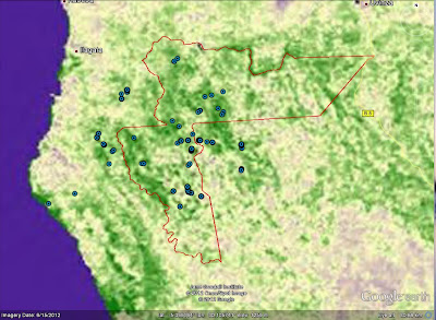
The concept of "roadless areas" is a well-established conservation measure coming from conservation biologists from all around the globe. The idea is that roads in most parts of the world lead to the unmanageable private access to the natural resources of an area, most often leading to ecosystem degradation and without the consent of the local and indigenous communities. Keeping an area roadless means that the specific territory is shielded against such exogenous pressures, thus sustaining its ecosystem services at the maximum possible level. An important tool which will drive environmental, development as well as global climate change policy forward will be the Google development of an interactive satellite map of the world's roadless areas.  
We were intrigued by Kriton’s idea, so we decided to give it a try.

Start with where the Roads are

We started by taking all the road data (plus rail and navigable waterways) in Google Maps today, and importing that into our Google Earth Engine platform for analysis. For example, here is what the road network in Australia looks like when zoomed out to country-scale:


Then figure out where the roads aren't

Based upon advice from Kriton Arsenis and his project collaborators in the Society for Conservation Biology, we decided to define a “Roadless Area” (for the purposes of this prototype map) as any area of land more than ten kilometers from the nearest road. Using the global-scale spatial-analytic capabilities of Google Earth Engine, we then generated this raster map, such that every pixel in the map is color-coded based on distance from the nearest road. Every pixel colored green is at least 10km from the nearest road, and therefore considered part of a Roadless Area. For example:


Or consider the island of Madagascar, home to some of the most unique species on Earth:


From these maps it becomes more apparent how the simple construction of new roads can fragment and disturb habitats, potentially driving threatened species closer to extinction.

Finally we decided to try running this “Roadless Area” algorithm at global-scale:


Large roadless areas are readily apparent such as the Amazon and Indonesian rainforests, Canadian boreal forest and Sahara desert.

Caveats and Next Steps

The road data used to produce these maps inevitably contains inaccuracies and omissions. The good news is that Google already has a tool, Google Map Maker, that can be used by anyone to submit new or corrected map data, and in fact this tool is already being used in partnership with the United Nations to support global emergency response. We look forward to continued development of this prototype, which can help to turn the abstract concept of “Roadless Areas” into something quite concrete and, we hope, useful to policymakers, scientists and communities around the world. To explore these Roadless Area maps yourself, visit the Google Earth Engine Map Gallery.

Posted by Rebecca Moore, Manager, Google Earth Outreach and Google Earth Engine

This month, heads of state, NGOs, scientists and business leaders from around the world will meet to discuss how best to reduce poverty, advance social equity and better protect the environment at the ...
This month, heads of state, NGOs, scientists and business leaders from around the world will meet to discuss how best to reduce poverty, advance social equity and better protect the environment at the United Nations Conference on Sustainable Development, also known as Rio+20.

As a company that believes deeply in sustainability, we wouldn’t miss this for the world. So from June 13 - 22, a group of Googlers from our Google Earth Outreach and Google Earth Engine teams will be joining many of our partners, including Chief Almir Surui, The Jane Goodall Institute, Imazon, Aliança de Terra, Amazon Sustainable Foundation and others to show how technology can support the conference’s core themes.

We’ll be posting updates on the Google Green Blog from the conference throughout the week, but we thought we’d offer a quick preview of how we’ll be participating:

  • Wednesday, June 13th - Friday, June 22nd: We invite all conference attendees to visit us at our booth in the Rio State Government Pavilion at Athletes’ Park. You’ll be able to tour the Earth and beyond in our Liquid Galaxy, an immersive Google Earth experience, and explore some of the work our partners have created using Google tools. 
  • Friday, June 15th: Ronaldo Barreto, Strategic Partner Manager for Latin America, will participate in Megacities Forum 2012, at a roundtable on “Future Cities and the Use of New Transport Technologies.” Ronaldo will show how tools such as Google Maps, Google Transit and Google Street View are being used to modernize Rio de Janeiro’s transportation infrastructure. 
  • Friday, June 15th: Rebecca Moore, Engineering Manager for Google Earth Engine and Google Earth Outreach, will speak at “No Roads to a Green Economy: Mapping Earth´s roadless areas and their services,” a discussion at the European Union Pavilion about the need to promote roadless areas as a means to conserve biodiversity and secure the rights of indigenous people.
  • Saturday, June 16th: Rebecca Moore will be joining Chief Almir Surui at the Rio+20 Corporate Sustainability Forum to share the latest news regarding our ongoing partnership with the Surui tribe. 
  • Sunday, June 17th: We’ll be holding an SD-Learning event, “From the Ground to the Cloud: New Tools for Sustainable Development,” which will be introduced by Brazilian Senator Eduardo Braga and will feature a presentation from Imazon on their work to create a deforestation monitoring system for Brazil, powered by Google Earth Engine. (Registration has closed for this event.) 
  • Monday, June 18th: All visitors to Rio+20 are welcome to join our Side Event, "Tools for Data Collection and Mapping: the Ground to the Cloud Story" at the Arena de Barra. We’ll be hearing from a number of partners about they work they’re doing with Google tools. Among others, the Jane Goodall Institute and Woods Hole Research Center will share their work estimating forest biomass over Tanzania with Google Earth Engine, and Aliança da Terra will talk about how their use of Open Data Kit and Google Maps Engine has transformed their operations. 
  • Tuesday, June 19th: we’ll be at the U.S. Government Pavilion to participate in panel discussions and demonstrations of our work with the Governor’s Forest and Climate Taskforce. 
These are only a few examples of the fascinating ways technology can help address some of our world’s most pressing challenges. Stay tuned for updates throughout the conference about the news our partners are sharing, and if you have any thoughts about how technology can help save the world -- or at least help us all be more environmentally responsible and support a sustainable future, let us know at #googleatrio20.